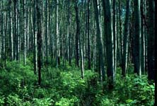
Deer and coyote range expansion into the boreal forest
 |
Our winter snow track surveys in northeastern Alberta show a pattern of strong association of white-tailed deer and coyotes with human footprint, particularly cutblocks and roads respectively, as measured at the township (100 km2) scale. There is anecdotal information that both species have been expanding northward into the boreal forest over the past 50-75 years, but the full extent and causal mechanisms remain obscure. Human activities could facilitate deer and coyote expansion through the creation of favorable foraging habitat (agriculture, younger forest, well sites) and/or creation of predator/competitor refugia whereby human activities reduce the presence of wolves thereby enhancing deer and coyote populations.
In addition, these potential mechanisms could operate at two scales. It is possible that local scale habitat alteration (creation of cutblocks, well sites, pipelines, roadside edges) simply provide deer and coyotes (through shifts in the small mammal community) with favorable habitat resulting in viable local populations. Alternatively, mechanisms may operate at a regional scale whereby major land conversion (agricultural or residential) provides both enhanced habitat and reduced wolf abundance. In this case, land conversion on the fringe of the boreal forest serves to create source populations that export individuals into surrounding habitats (creation of a source-sink dynamic).
Depending on the scale and mechanism involved, the management options to reduce the expansion of deer and coyotes would be very different. For example, local-scale habitat mechanisms could be managed by restoration of local human footprint (cutblocks, well sites, seismic, pipelines) to boreal forest. Regional-scale mechanisms require a combination of management of populations within the area of land conversion to reduce source populations and the creation of buffers to reduce access by non-native species to surrounding habitats. If human presence alone creates wolf exclusion zones, the presence of people, rather than footprint, may have to be managed. Further, any plans for the use of predator management to protect caribou for example, may indirectly increase alternate prey such as deer and moose and ultimately be counterproductive.
We will test the local versus regional habitat enhancement hypotheses through a broad-scale assessment of the distribution and relative abundance of coyotes, deer, and wolves in relation to local human footprint and regional agricultural conversion across the northern forested region of Alberta. We now have complete GIS layers for vegetation cover (Alberta Ground Cover Classification supplied by Dr. Arturo Sanchez, Department of Earth and Atmospheric Sciences) and human footprint (roads, pipelines, seismic, well sites, cutblocks, agriculture) for the forested area of the province and from this data set we will select sample points (50 per year for each of 3 years) that provide maximum statistical contrasts between 3 types of human footprint; energy sector (seismic, access roads, well sites and pipelines), forestry (cutblocks and roads), and agriculture (amount and proximity) while controlling for spatial gradients (northing in particular) and vegetation type.
Human footprint will be measured at the township scale and within each sample township we will collect the following biological information: 1) relative deer abundance as measured by snow track transects in winter and pellet plots in summer and 2) wolf and coyote relative abundance using winter track surveys and baited trail camera stations (2-4 Bushnell digital infrared trail cameras baited with fish oil and dog food in each township). Cameras will run continuously for 1 month in both early winter and summer. The data will be used to generate regression models to determine the relative importance of local human footprint (type and amount) and regional footprint (distance to major agricultural conversion).
The regional surveys will be complemented with intensive local radio telemetry studies of deer and coyote. We will deploy GPS (Global Positioning System) transmitters on deer and coyotes captured at variable distances from extensive agriculture. We will use the locations downloaded from the collars to develop resource selection functions to determine the degree to which deer and coyotes select human-created habitats (forest cutblocks, well sites and pipelines, and agriculture) and how this varies depending on distance from agriculture. The information will also be used to determine whether or not individuals employ a resident strategy (local home ranges) or commuter strategy (regular forays into adjacent habitat from the agricultural fringe).
Finally, we will collect additional data on deer population structure through collaboration with Drs. David Coltman and Evelyn Merrill who are interested in the spread of Chronic Wasting Disease in Alberta. Coltman will genotype samples from deer collected by hunters and field staff and use molecular and quantitative genetics techniques to determine the degree of mixing between different areas of the province. By identifying biologically meaningful population units we will evaluate whether the population structure of deer is indicative of a regional spread model or whether discrete population units exist as a patchy metapopulation across Alberta.