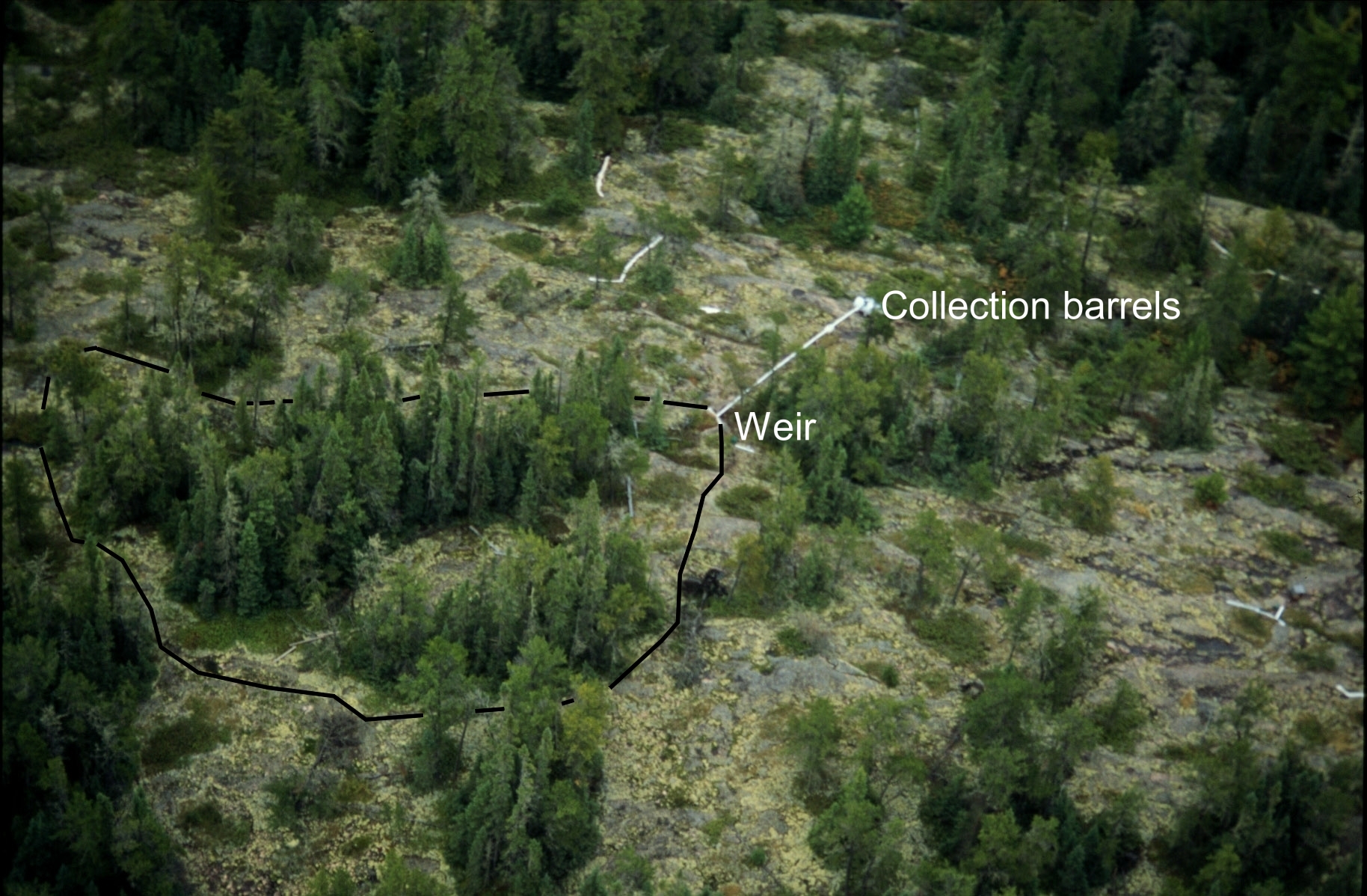
Figure 1. We sprayed the understory of a 1000 m2 forested upland catchment with 202Hg mixed in throughfall water in July 1999. The boundaries of the catchment are outlined in black. The amount of 202Hg leaving the catchment via evasion to the atmosphere and runoff was monitored until freeze-up in late October. Runoff was captured below the catchment weir in a series of barrels. Storage of 202Hg (for example, on above-ground vegetation and in soils) was also quantified in the area
|
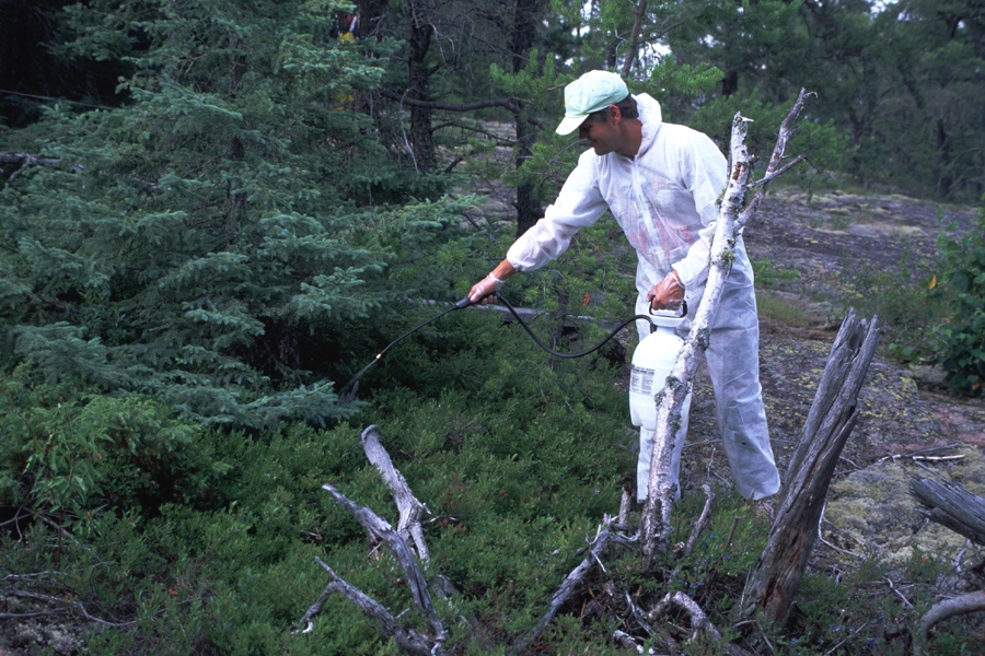
Figure 2. David Krabbenhoft, from the U.S. Geological Survey, is seen here spraying the 202Hg mixture onto the understory of the upland Forested catchment.
|
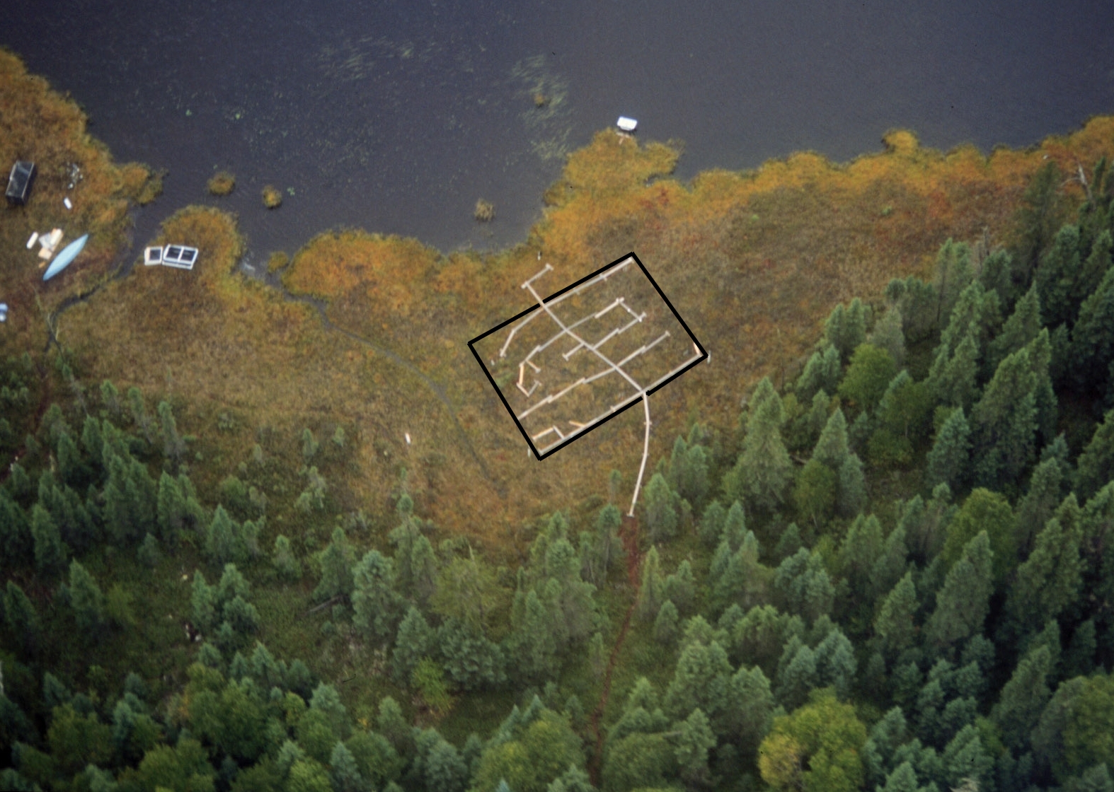
Figure 3. We also sprayed a portion of a lake-side wetland with 202Hg mixed in precipitation water in July 1999. The boundaries of the sprayed area are outlined in black. Boardwalks were installed in the sprayed portion of the wetland to reduce disturbance. The amount of 202Hg leaving the catchment via evasion to the atmosphere and in groundwater was monitored until freeze-up in late October. Storage of 202Hg (for example, on peat) was also quantified in the area.
|
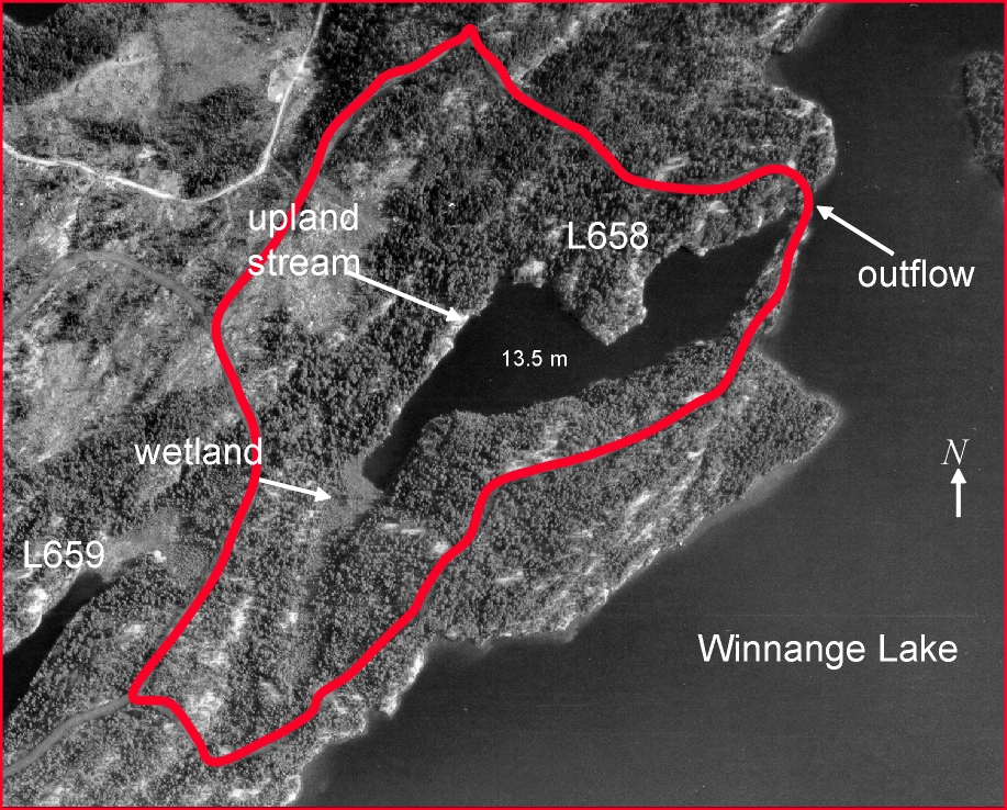
Figure 4. This is an aerial photograph of Lake 658 at the Experimental Lakes Area in northwestern Ontario. The lake’s watershed boundaries are outlined in red. The Lake 658 watershed will most likely be the site of the whole-ecosystem Hg loading experiment. Three different isotopes of Hg will be loaded to the watershed: one directly to the lake surface, a second to the wetland area, and a third to the upland forest canopy. We will then monitor the proportion of each Hg isotope as it passes through the food web into fish.
|